US Braces for First Widespread Frost of the Season This Weekend, Tens of Millions Affected - Sing Tao Daily

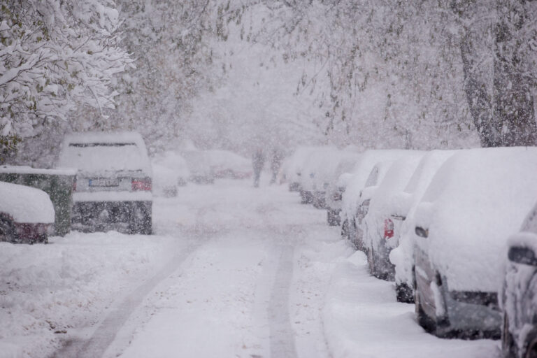
The US will see its first widespread freeze of the season this weekend, stretching from eastern Oklahoma all the way to the Carolina coast and as far south as southern Alabama, with frost and freeze warnings issued in many areas and millions of residents potentially affected.
Meanwhile, parts of upstate New York saw more than a foot of snow on Friday, the California Sierra Nevada is expected to receive up to 18 inches of snow, and parts of the West Coast and Texas also face heavy rain.
Key points: · Affected areas: multiple states across the central and southeastern US, from eastern Oklahoma to the Carolina coast · Frost and freeze warnings: covering cities including Tulsa, Little Rock, Birmingham, Atlanta and Raleigh · New York snow: Hartwick recorded 12.5 inches on Friday morning, with some areas exceeding 10 inches · California mountain snow: Sierra Nevada above 6,000 feet, expected 12 to 18 inches · Texas heavy rain: 1 to 2 inches widespread across the southeast on Sunday, with localized amounts of 3 to 5 inches Southeast Faces First Widespread Frost of the Season According to NBC News, a mass of cold air will sweep across the central and southeastern US over the weekend, pushing temperatures in many places to around or below freezing.
The National Weather Service forecasts wind chill values of 24°F and 27°F in Chicago on Saturday and Sunday respectively; 34°F and 40°F in New York City; 31°F and 32°F in Atlanta; and 35°F and 32°F in Tallahassee, Florida.
Frost and freeze warnings extend from eastern Oklahoma to the Carolina coast and as far south as southern Alabama.
Cities under the warnings include Tulsa, Oklahoma; Little Rock, Arkansas; Birmingham, Alabama; Atlanta, Georgia; and Raleigh, North Carolina.
More Than a Foot of Snow in Parts of New York A departing storm brought heavy snow to parts of New York on Friday.
As of Friday morning, Hartwick had accumulated 12.5 inches, Burlington 12 inches, Exeter Center 11.5 inches and Cherry Valley 10 inches.
Several locations in the Catskills also recorded 3 to 7 inches of snow.
Snowfall is expected to taper off on Friday, but the Interstate 95 corridor from Philadelphia to New York may still see multiple rounds of rain.
There is also a slight risk of coastal flooding along the New Jersey coast and near Cape May.
The storm will move offshore on Saturday, but subsequent northerly winds may bring lake-effect snow, showers and light snow to the Adirondacks, the Berkshires, and the Green and White Mountains in Vermont and New Hampshire.
Back-to-Back Pacific Storms Hit the West Coast A Pacific storm also made landfall on the West Coast on Friday, with heavy rain expected from northern Washington to Southern California and heavy snow in the Sierra Nevada.
Parts of Southern California, including the Los Angeles metropolitan area, may also see isolated thunderstorms.
By Saturday, rainfall totals could reach 3 inches in parts of Northern California and southwestern Oregon.
The Sierra Nevada above 6,000 feet is expected to receive 12 to 18 inches of snow.
From Saturday night into Sunday, another storm system will move into the Pacific Northwest, keeping wet and cold conditions in place along the West Coast.
Southeast Texas Braces for Heavy Rain and Flooding on Sunday Heavy rain is possible from southeastern Texas to western Louisiana on Sunday, with some cities facing a risk of urban flooding.
General rainfall of 1 to 2 inches is expected, with localized amounts of 3 to 5 inches along the southeastern Texas coast.
Houston, Galveston, Beaumont and Lake Charles, Louisiana, could all be affected.
Severe thunderstorms with damaging winds are also possible from Beaumont to Brownsville in southeastern Texas.
Adobe Stock Source: NBC News
Comments (0)